
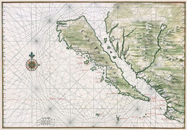
California’s San Andreas fault is slowly shifting LA away from the mainland. But we don’t have to look to the future to imagine a disjointed coastline. Instead we can look to the past, to the maps of the 17th and 18th centuries that share a strange discrepancy: the inclusion of the Island of California.

And this wasn’t a small island. Maps showed it paralleling the entire coast from Puget Sound in the Northwest down to Baja California. With an error this big, we’d expect to find one misinformed map. But this imaginary island—in striking detail—was picked up by Dutch cartographers and essentially became the standard for the next century.

These maps came during a time of European exploration. It’s speculated that the journal writings of a Spanish priest contributed to the widespread mistake. In his 1602 journal, Antonio de la Ascension wrote that California was separated from North America by the “Mediterranean Sea of California,” though the maps of the next century would label it the “Gulf of California” or “Red Sea.”

While we might expect a bit more accuracy from these surveyors, it’s fair to note that for the Europeans of this time, California was as unexplored as Antarctica. It took a king to straighten things out. It was King Ferdinand VI of Spain who decreed in 1747 that, no, “California is not an island,” and that the mapmakers must change their display.
